Mostrando 632 resultados
Descripción archivística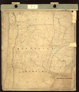
Mapa de la República Argentina mostrando la Línea de ferrocarril proyectado entre el Río Paraná y Córdoba complilado del de Sir W. Parish y otros recursos. Impreso.
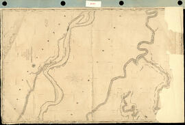
Track Survey of the River Paraná. Sheet N° 4. (Curumbé Island to Arroyo Soldado). [Levantamiento del trayecto del Río Paraná. Hoja N ° 4. (Isla Curumbé a Arroyo Soldado).] Impreso.
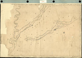
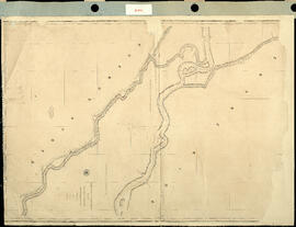
Track Survey of the river Paraná. Sheet N° 5. (Arroyo Soldado to Acollarado Island). [Levantamiento del trayecto del río Paraná. Hoja N ° 5. (Arroyo Soldado a Isla Acollarado).] Impreso.
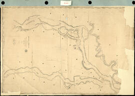
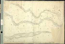
Track Survey of the River Paraná. Sheet N° 6 (Acollarado Island to Mouth of Colastiné). [Levantamiento del trayectos del Río Paraná. Hoja N ° 6 (Isla Acollarado a la Boca de Colastiné).] Impreso.
Track Survey of the River Paraná. Sheet N°8. (Latitud 29° 55' to Latitud 28° 40'). [Levantamiento del trayecto del Río Paraná. Hoja N ° 8. (Latitud 29 ° 55 'a Latitud 28 ° 40').] Impreso.
Track Survey of the River Uruguay. Sheet N° 2. [Levantamiento del trayecto del río Uruguay. Hoja N°2.] Impreso.
Track Survey of the River Uruguay with portions of the Rivers Negro and Gualeguaychu. Sheet N° 1. [Levantamiento del trayecto del río Uruguay con porciones de los ríos Negro y Gualeguaychu. Hoja N ° 1.] Impreso.
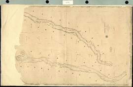
Track Survey of the River Paraná. Sheet N° 3. (Paloma Island to Curumbé Island.) [Levantamiento del trayecto del Río Paraná. Hoja N ° 3. (Isla Paloma a Isla Curumbé.).] Impreso.
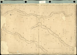
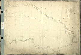
Track Survey of the River Paraná. Sheet N° 7. (Mouth of Colastiné to Latitud 29°55"). [Levantamiento del trayecto del Río Paraná. Hoja N ° 7. (Boca de Colastiné a Latitud 29 ° 55").] Impreso.
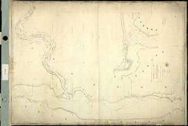
Track Survey of the rivers Salado, Paraná and Colastiné. [Levantamiento del trayecto de los ríos Salado, Paraná y Colastiné.] Impreso.
Resultados 61 a 70 de 632