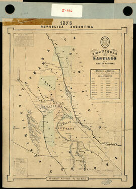
Provincia de Santiago por Nicolás Grondona ingeniero. Impreso.
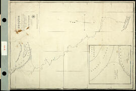
Croquis para servir a la memoria sobre reconocimiento del Río Carabelas efectuado por orden del ministro de Guerra y Marina señor Doctor Don Benjamín Victorica por Hunter Davison y W. Parfitt. Impreso.
Track Survey of the River Paraná. Sheet N° 4. (Curumbé Island to Arroyo Soldado). [Levantamiento del trayecto del Río Paraná. Hoja N ° 4. (Isla Curumbé a Arroyo Soldado).] Impreso.
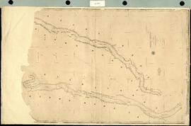
Track Survey of the river Paraná. Sheet N° 5. (Arroyo Soldado to Acollarado Island). [Levantamiento del trayecto del río Paraná. Hoja N ° 5. (Arroyo Soldado a Isla Acollarado).] Impreso.
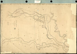
Track Survey of the River Paraná. Sheet N° 6 (Acollarado Island to Mouth of Colastiné). [Levantamiento del trayectos del Río Paraná. Hoja N ° 6 (Isla Acollarado a la Boca de Colastiné).] Impreso.
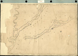
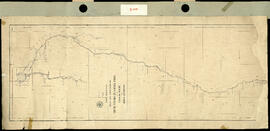
Track Survey of the River Paraná. Sheet N°8. (Latitud 29° 55' to Latitud 28° 40'). [Levantamiento del trayecto del Río Paraná. Hoja N ° 8. (Latitud 29 ° 55 'a Latitud 28 ° 40').] Impreso.
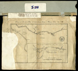
Plano del Río de la Plata del Cabo Santa Maria a Buenos Aires. Calco.
Reference chart to the track survey of the tributaries of the Río de la Plata. [Carta de referencia del levantamiento de vías de los afluentes del Río de la Plata.] Impreso.
Rio de la Plata. Published by Charles Wilson, [late J. W. Norie & Wilson] N° 157, Leadenhall street, London. E.C. [Río de la Plata. Publicado por Charles Wilson, [difunto J. W. Norie & Wilson] N ° 157, Calle leadenhall, Londres. CE.] Impreso.
Map of the basin of La Plata, based upon the results of the expedition under the comand of Thos. J. Page, U.S. Navy, in the years 1853-54-55&56 and of the adyacent countries. Compiled from the best authorities. [Mapa de la cuenca de La Plata, basado en los resultados de la expedición bajo el mando de Thos. J. Page, Armada de los Estados Unidos, en los años 1853-54-55 y 56 y de los países adyacentes. Compilado de las mejores autoridades.] Impreso.
![Rio de la Plata. Published by Charles Wilson, [late J. W. Norie & Wilson] N° 157, Leadenhall ...](/uploads/r/archivo-general-de-la-nacion-argentina/8/a/5/8a561489cb00abbe08db83a2032cac0aa306027a52e4a59eb7b0dd1d7cc7b683/MAP-II-254_142.jpg)